Map Tiles
The PICSA Map has a base world outline and some specific country outlines. There is also an optional online base layer of a full map from openstreetmap
About the Data
The map data consists of base layer images and geojson overlay
The geojson is downloaded from natural earth, and optimised by:
- Filter to only include countries used for PICSA app
- Remove columns to only keep those use for PICSA app (currently just administrative name)
- Converting to topojson
This should result in drastic reduction, e.g. just retaining admin features and restricting to africa world geoJson compresses 839KB -> 23KB (40x!)
Adding GeoJson Data
Data can be downloaded from: https://www.naturalearthdata.com/downloads/
For example country boundaries can be exported from https://www.naturalearthdata.com/downloads/10m-cultural-vectors/
Once downloaded it should be processed using QGIS (or similar) to remove features.
For example, see the screenshot below to filter to only include a small number of countries
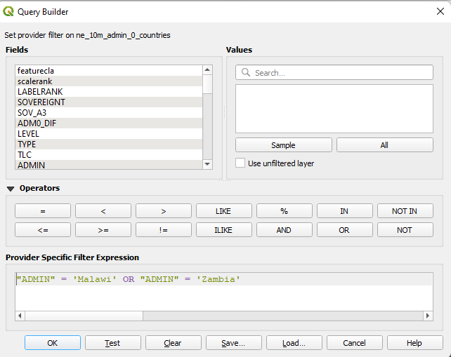
NOTE - if using countries that do not border it is best to separate as multiple layers
Frontend integration
The frontend is map is built with leaflet JS. CSS will need to be included either via a scss import statement or bundled into the build, e.g.
 "styles": [
        "styles.css",
        "./node_modules/leaflet/dist/leaflet.css"
    ],
Adding offline basemap
Basemap tiles should be exported as raster images (e.g. PNG) from QGIS.
The easiest way to load basemap tiles is via the QuickMapServices plugin to load an OSM layer
This layer can be exported and clipped to the geojson layer using the QMetaTiles plugin\
An example of a basemap with geojson layer can be seen below
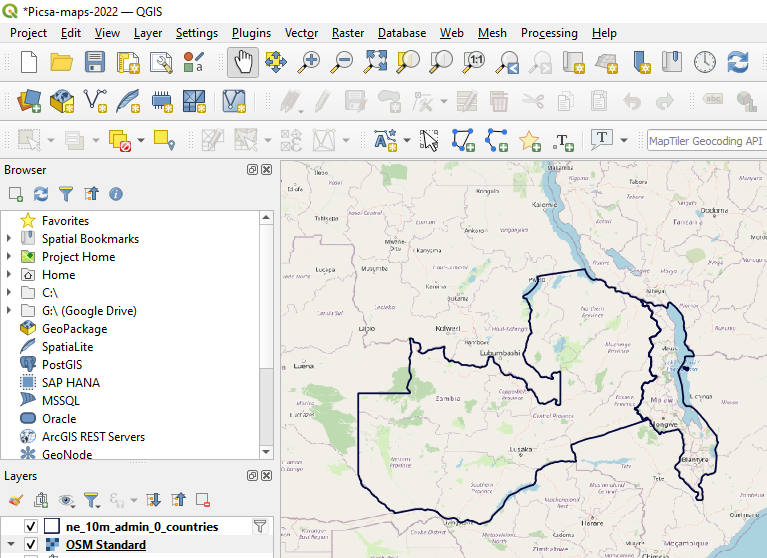
When exporting the basemap can be clipped to the geojson layer extent
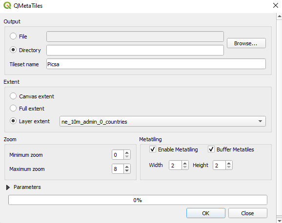
Typically zoom level of 7-8 should be sufficient, but this can be explored online at https://www.openstreetmap.org/#map=8/-14.837/35.057 (zoom level in url)
Compress tiles
The downloaded tiles are typically not compressed very well and so an extra step should be taken to make the files smaller. A lightweight script is included here, which can be run via:
yarn ts-node tools\workflows\processMapTiles.tsThe compressed files should appear same folder as webp images
Copy to assets
This folder should be copied to the project assets folder, where the map tiles will be served from
Attributes
The final step is to set the attribute on the picsa-map tag to use local images, this can be done by setting any properties within assetMapOptions. i.e.
 basemapOptions: IBasemapOptions = {
    src: 'assets/mapTiles/raw/{z}/{x}/{y}.webp',
    maxNativeZoom: 8
  };
(component.ts)
<picsa-map
      [basemapOptions]="basemapOptions"
    ></picsa-map>
(component.html)
Vector basemaps
QGIS added support for vector basemaps as of v3.14, however integration within the app is not straightforward. Some preliminary work has been done to include, however on hold until there is greater need for it
This work is split into a few components
-
Source of vector basemaps This could be something such as https://data.maptiler.com/downloads/dataset/osm/#0.22/0/0 https://openmaptiles.org/ NOTE - as well as map server url will also need to take note of
tiles.jsonandstyle.jsonfiles which contain map definition data -
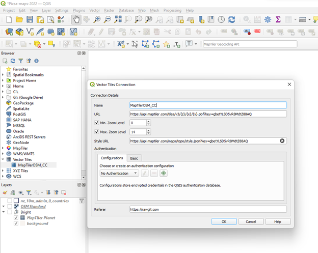
Use of QGIS to load vector basemaps. See article below for explanation of how to configure https://wanderingcartographer.wordpress.com/2021/01/09/qgis-3-and-vector-map-tiles/
E.g. see below for adding a testing set of map vector tiles from maptiler.
Maptiler also has its own plugin to import from their global repositories (search ‘maptiler’)
-
Ability to merge multiple sources (if required). E.g. maptiler examples typically include vector basemap along side hill shading and contour line raster maps. It is not clear if QGIS can fully support these formats. E.g. issue: https://github.com/geometalab/Vector-Tiles-Reader-QGIS-Plugin/issues/266
-
Troubleshoot compatibility issues, e.g. installing missing font files (as shown in )
-
Find means to export tile subset (seems like qmetatiles only supports pngs, not vector pbf files)
-
Parse vector files to geojson As vectors are encoded using protobuf additional work required to decode either during map render or as a precompile step. https://github.com/mapbox/pbf
-
Integrate with leafletjs in frontend,e.g. https://github.com/mapbox/mapbox-gl-leaflet https://github.com/Leaflet/Leaflet.VectorGrid
-
Evaluate space saved / quality gained from method overall
Additional Optimisations
Previously some work was done to explore use of topojson, however currently on hold https://jeffpaine.github.io/geojson-topojson/ or https://mygeodata.cloud/converter/geojson-to-topojson